
Hiking and Walking Trails
Lubec, Cutler, Trescott, Whiting, Pembroke, Dennysville, and Edmunds, Maine and Campobello Island, New Brunswick, Canada
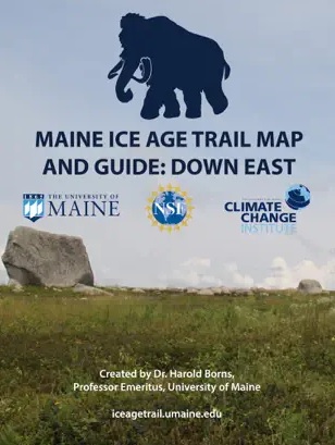
Downeast Maine Ice Age Trail Map, Apps and Guide
Interactive trail map, apps and guide from the University of Maine. Videos of the Downeast Ice Age Trail stops. Stop 39, the Lubec Moraine and Stop 42, West Quoddy Peat are about Lubec
Walking in Lubec
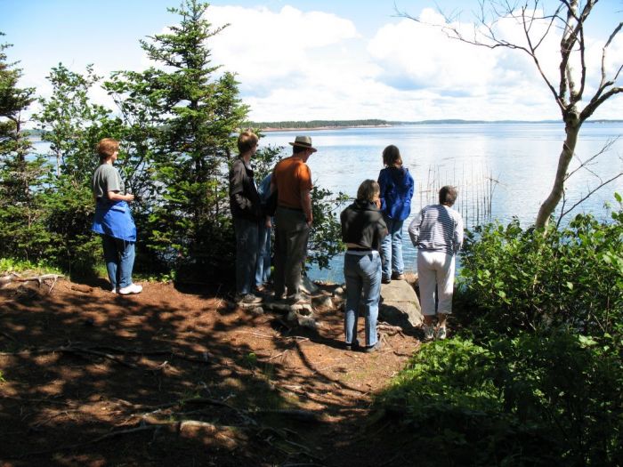
Lubec is a wonderful town for walking, from the hills of Main and School Streets with their historical captains' homes to the cobbled sidewalks of Water Street and the varying terrain of Mowry Beach at the south end of Pleasant Street. Many former empty lots are now green spaces, such as Flatiron Corner as you enter the Village, or the Lost Fishermen's Memorial Park at the northern end of Water Street, with its view overlooking Johnson's and Passamaquoddy Bays, and Campobello Island, New Brunswick across the Lubec Narrows.
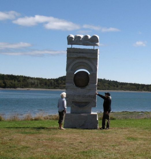
Stockford Park on Lower Water Street boasts Lubec's Schoodic Sculpture, part of the international sculpture trail. The Schoodic International Sculpture Symposium is an artist in residency program that gives sculptors from Maine and around the world the opportunity to bring a world class collection of large granite works of art throughout Maine and New Brunswick. Lubec's sculpure, named "Beyond the Horizon" by Valerian Jikia from the Republic of Georgia, represents his attempt to compound the water, sun and rainbow, and create a sculpture with positive energy in the spatial dramaturgy. Some can even hear the energy as music when the wind blows through the sculpture.
Outdoor Activities: Hiking
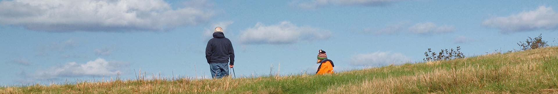
Lubec’s peaceful, rural / coastal area with a dispersed population and little traffic provide the casual walker and serious hiker with spectacular scenic trails.
The variety of trails include steep, windswept coastal headlands, tidal flats, coastal islands, preserved peat bogs, beaches at low tide, boreal (northern) hardwood forests, grasslands and meadows.
For an unforgettable walking or hiking experience come and enjoy the tranquility and outstanding natural beauty in such abundance in our area.
Hiking opportunities abound in this area. Varied terrain and habitats can lead an intrepid explorer along high, bold cliffs or through moss-covered forests in which one expects to see a gnome pop its head out from behind a tree any moment.
There are several boardwalks through raised coastal bogs with informational signs during the summer season. This habitat exists only in a very small slice of the U.S., and coastal Lubec can boast several of these fascinating and fragile ecosystems. Soils are thin, weather can be extreme, and very changeable. Tides and currents are impressive and formidable, so be careful, be prepared, tread gently on the land, and enjoy! There are choices for hikes that are long or short, meandering to challenging - all within a short drive from Lubec.
COBSCOOK TRAILS, an informative map of Cobscook Bay and Bold Coast, Maine hikes is now available online! Paper copies of the map are available for free at businesses around the region as well as the Cobscook Trails Partner offices. Partners are Maine Coast Heritage Trust, Downeast Coastal Conservancy, The Nature Conservancy, Maine Department of Inland Fisheries and Wildlife, Maine Department of Conservation: Parks and Lands, and the U.S. Department of the Interior: Fish and Wildlife Service.
Links to Hiking Trails In This Area:
Cobscook Bay Region Get Active! map
Geologic History of the Lubec Embayment
Trails in Quoddy Head State Park
Trails in Cutler Coast Public Reserved Land
Trails in Roosevelt-Campobello International Park
Trails in Cobscook Bay State Park
Trails in Moosehorn National Wildlife refuge
Trail maps available at the Baring office and at trailheads during the summer.
Maine Wildlife Management Areas (Horan Head, Morong Point, Commissary Point, Dennison Point)
Many local trails can be found on the Maine Trail Finder.
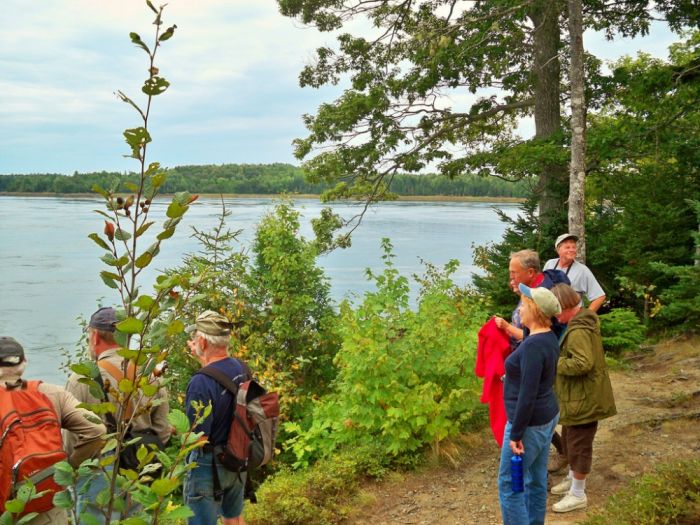
Downeast Coastal Conservancy (conserved lands, Pike Lands, Mowry Beach, Klondike Mountain, and events) and Maine Coast Heritage Trust (Treat Island, Hamilton Cove, Boot Head, Bog Brook Cove preserves, and field trips) have guided hikes and field trips on their properties throughout the year. They also provide volunteer opportunities to work on trail development and maintenance.
Cobscook Shores is a group of waterfront parks that are privately owned by Cobscook Shores Inc., a family funded Maine charitable foundation. The parklands offer public access and recreational use including hiking, biking, camping, and paddling. Cobscook Shores, Inc. works with local communities in the design and implementation of conservation and education programs and projects to ensure the support and involvement of community stakeholders, and to help all residents of the Cobscook Bay region to enjoy and appreciate the stunning natural environment found in that part of easternmost Maine. Both areas will be the focus of the Maine Outdoor Education Program.
The Pike Lands
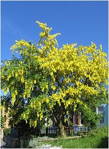
The Pike Lands are rich in ecological diversity with low lying moist areas that support moss and lichen habitats, tidal vegetative zones, an old apple orchard, spruce and fir trees one might expect near the Maine coast, as well as plantings of unique species not typically found in the area, such as Kentucky Coffee Tree, Dawn Redwood, Golden Chain Tree.
Naturalist and professor of horticulture, Dr. Radciffe Pike planted these and other botanical anomalies in the 1960s. With the help of Maine Coast Heritage Trust, Downeast Coastal Conservancy has identified these exotic species and created a botanical trail map to enhance visitors' experience through a self-guided walking tour of the distinctive plants that live on as Dr. Radcliffe Pike's legacy and gift to the community.
The Pike Lands are on North Lubec Road, 5 miles from Route 189 to the Downeast Adventures sign (on the right) near the end of the paved road.